31 January, 2023
Geoimage collaborates with the South Australian Government in environmental recovery efforts following significant flood events
In late November 2022, heavy rainfall and subsequent flooding in Australia’s eastern states caused increased River Murray flows and significant flood events in the River Murray townships and surrounding areas.
The River Murray is a vital source of irrigation, tourism and water supply for South Australia and is also a popular spot for recreational activities such as boating and fishing, as well as being a habitat for a diverse range of plants and wildlife.
To support environmental recovery efforts suppliers on the Department for Environment and Water (DEW) Preferred Supplier Panel for Spatial Imagery Services were requested to provide a multispectral high-resolution imagery solution to derive an inundation extent at peak flows. Geoimage was chosen as the preferred provider after meeting the project specifications and providing excellent value for money.
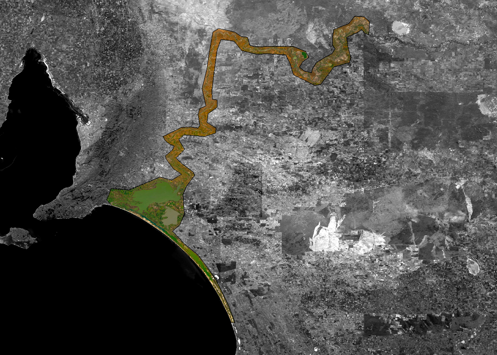
Geoimage proposed utilising the Airbus Defence and Space SPOT 6/7 satellite constellation to capture high-resolution imagery of the affected areas. The constellation, which has a 1.5-meter-resolution spatial sensor and a 60-kilometre-wide-swath, is well-suited for large-scale environmental monitoring. As a Diamond Airbus partner, Geoimage also had priority in the region and the ability to recapture cloud-affected areas as needed.
“The Airbus Defence and Space SPOT 6/7 satellite constellation provides an efficient and cost-effective solution for acquiring high-resolution images of vast areas,” explained Mark Covington, General Manager of Geoimage. “Its rapid and efficient capabilities make it an ideal candidate for supporting decision-making in a diverse range of industries and applications, and for completing this project in a timely manner.”
The process of capturing the flood waters from the river began in December 2022 and is scheduled to be completed by the end of January 2023.
Following the acquisition of the area of interest (AOI) from the river, the Geoimage processing team will begin processing the raw image data, resulting in an orthorectified, seamless, colour-balanced image mosaic that will be delivered to DEW within the initial weeks of February.