Technical Specifications
| Provider | Maxar |
| Satellites | 4 (6 planned) |
| Resolution | Panchromatic nadir 0.34m Multispectral nadir: 1.36m |
| Swath width | 10km |
| Bands | Panchromatic: 450nm - 800nm 8 Multispectral; Coastal Blue: 400nm - 450nm Blue: 450nm - 510nm Green: 510nm - 580nm Yellow: 585 - 625nm Red: 630nm - 690nm Red Edge1: 695nm - 715nm Red Edge2: 730nm - 750nm Near-IR: 770nm - 895nm |
| Stereo available | Yes |
| Coverage | 6M sq km per day (Full constellation) |
| Accuracy | < 5m CE90 without ground control points < 1.5m RMSE |
| Altitude | 518km |
About
WorldView Legion 1 and 2 launched during April 2024 at the Vandenberg Space Force Base in California, USA whilst WorldView Legion 3 and 4 launched in August 2024 at the Cape Canaveral Space Force Station in Florida, USA. These will be the first four of six WorldView Legion satellites, providing the highest resolution commercially available at the time of the development. Developed by Maxar, the six satellites will allow the capabilities to capture an area 15 times per day over in-demand areas, more than tripling the current capabilities (Maxar satellites) to collect sub 30cm high-resolution optical imagery and multispectral imagery enabled by its 8-band sensors.
WorldView Legion satellites have a mix between sun-synchronous and mid-inclination orbits, allowing the satellites ability to revisit high-interest areas in times of critical and time-sensitive decisions.

15cm HD - 30cm high-resolution imagery
Highest resolution commercially available within the fields of mining, exploration, infrastructure and environmental

Multispectral data and wide coverage
Wide swath multispectral data enables large-scale mapping and regional monitoring

Frequent revisits with full constellation
Next level revisiting capabilities with up to 15 times per day
Features and Benefits
- WorldView Legion satellites provide 8-band VNIR multispectral imagery for a wide variety of applications.
- Industry-leading precision geolocation accuracy without ground control points.
- Ability to capture large mono and stereoscopic collection eliminating the need for temporal variations.
- WorldView Legion can be flown at a range of altitudes for between 29 and 50cm GSD.
- 50cm Digital Elevation Models (DEM) for accurate DEM production.
- Benefits include vegetation classification for invasive species; forestry monitoring for illegal logging; construction monitoring in the urban and mining landscape; greenfield exploration via alteration mineral mapping and rapid updates of digital twins.
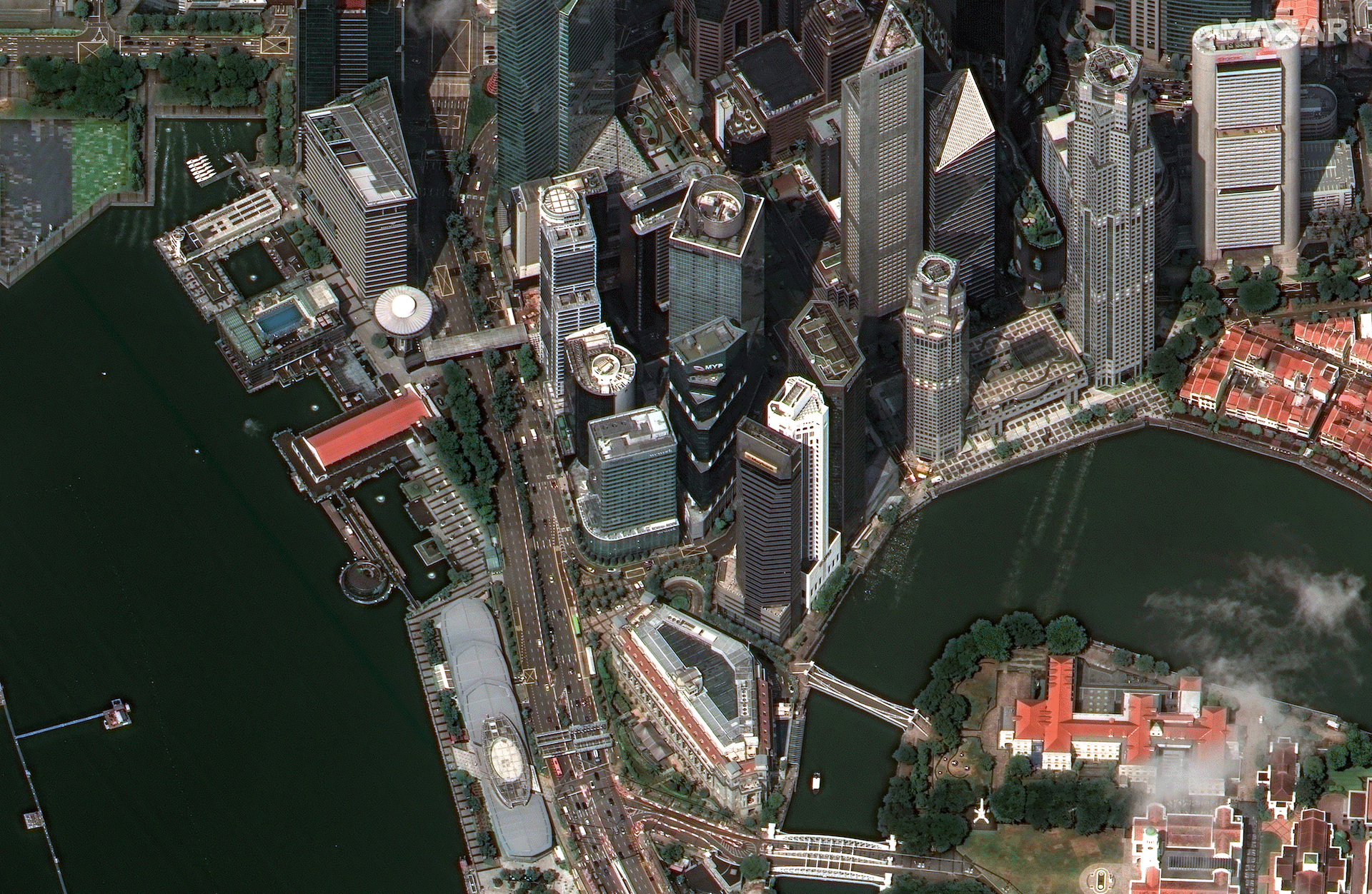
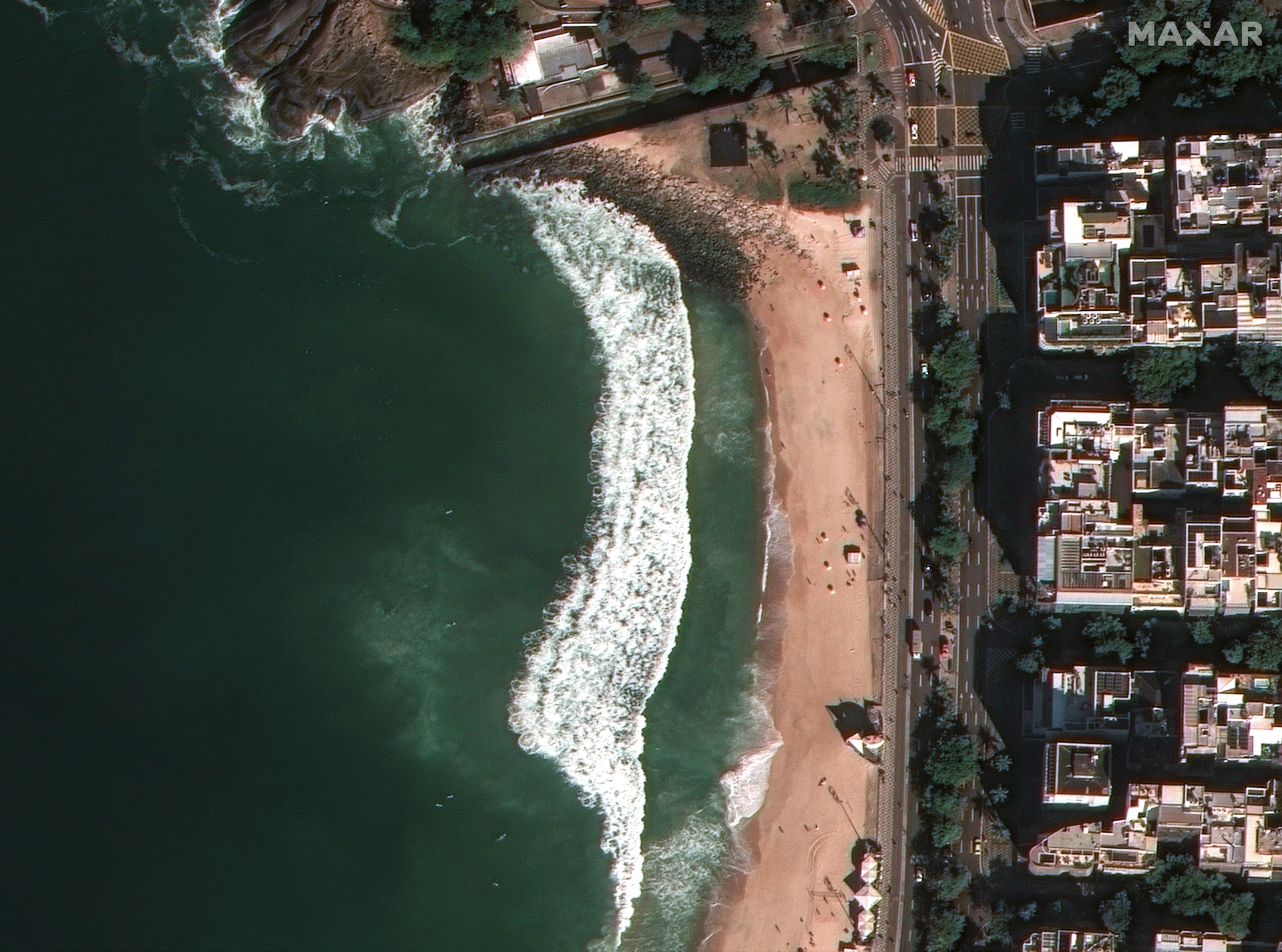
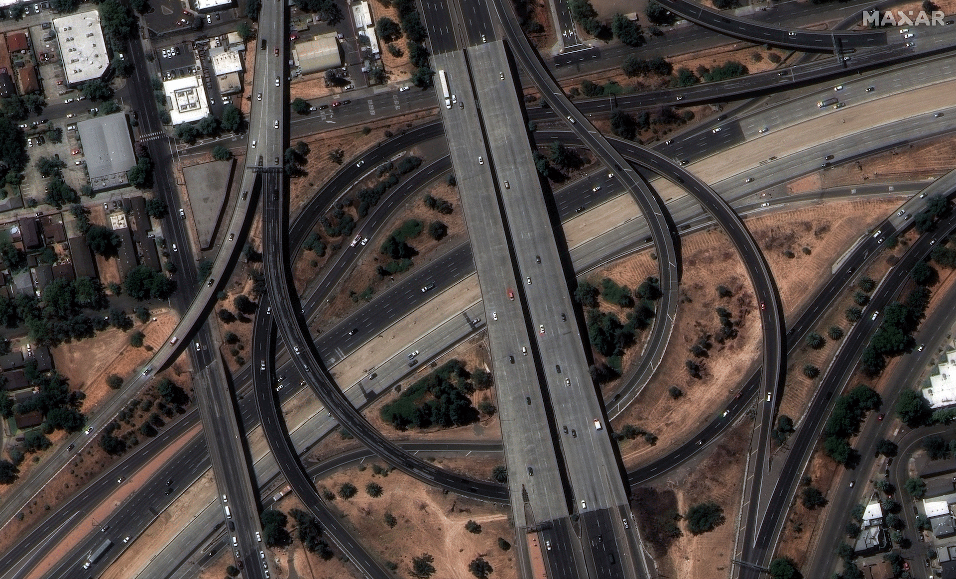
Sample Images