Technical Specifications
| Provider | Maxar Technologies |
| Satellites | 1 |
| Resolution | Panchromatic: 50cm GSD |
| Swath width | 16.4km at nadir |
| Accuracy | 5m CE90 at nadir 40cm with suitable ground control |
| Bands | Panchromatic: 450-800 nm Coastal: 400-450 nm Blue: 450-510 nm Green: 510-580 nm Yellow: 585-625 nm Red: 630-690 nm Red Edge: 705-745 nm Near Infrared 1: 770-895 nm Near Infrared 2: 860-1040 nm |
| Stereo avaliable | Yes |
| Coverage | Up to 975,000 km² per day |
| Altitude | 770 km |
About
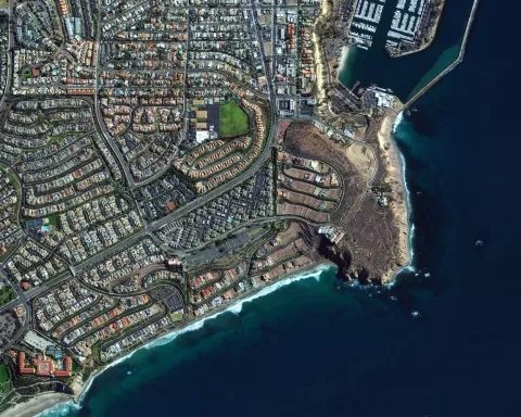
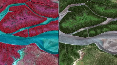
Maxar's WorldView-2 was launched from Vandenberg Air Force Base, California on October 8, 2009, and was declared fully operational on January 6, 2010. With the capacity to collect up to 975,000 km² of imagery per day, it offers unsurpassed accuracy, agility, capacity, and spectral diversity. WorldView-2 is unique in that it captures high-resolution imagery with eight spectral bands, compared to the usual four-band satellite range.

Frequent revisits
GeoEye-1 revisits any location on Earth every 3 days.

Swath width
The satellite has a nadir swath width of 15.2km.

Accuracy
Achieve 3m geolocation accuracy allowing for precise mapping.
Features and Benefits
- Increased spectral bands provide unique opportunities for remote sensing analysis of various areas, including vegetation, coastal environments, agriculture, and geology
- Improved agility, accuracy, and stereo capability
- 8-band multispectral imagery with sub-meter resolution
- 16.4 km swath width at nadir.


