Technical Specifications
| Provider | NASA |
| Satellites | 1 |
| Resolution | VNIR: 15m SWIR: 30m TIR: 90m |
| Swath width | 60km at nadir |
| Accuracy | 20-30m at nadir |
| Bands | VNIR Band 1 (Green): 520-600 nm VNIR Band 2 (Red): 630-690 nm VNIR Band 3 (NIR): 780-860 nm SWIR Band 4: 1.6-1.7 μm SWIR Band 5: 2.145-2.185 μm SWIR Band 6: 2.185-2.225 μm SWIR Band 7: 2.235-2.285 μm SWIR Band 8: 2.295-2.365 μm SWIR Band 9: 2.36-2.43 μm TIR Band 10: 8.125-8.475 μm TIR Band 11: 8.475-8.825 μm TIR Band 12: 8.925-9.275 μm TIR Band 13: 10.25-10.95 μm TIR Band 14: 10.95-11.65 μm |
| Coverage | Up to 43,000 km² per day |
| Altitude | 705 km |
About
ASTER, or the Advanced Spaceborne Thermal Emission and Reflectance Radiometer, is a state-of-the-art imaging instrument onboard NASA's Terra satellite. Terra was launched in 1999 and has five instrument sensor systems, with ASTER being one of them. It provides a unique combination of wide spectral coverage and medium spatial resolution, making it valuable for a wide array of applications, including hazard monitoring, geology and soils, and land surface climatology. ASTER consists of three subsystems - VNIR, SWIR, and TIR - and is capable of generating along-track stereo image pairs for creating digital elevation models.

Multispectral and thermal imaging
Multispectral and thermal imaging for vegetation, soil, hydrology, and resource management applications.
Wide swath width
Swath width of 60km at nadir, providing broad coverage for a range of applications
Spectral analysis
Used within Geoimage's Spectral Suite, a set of image enhancements that make use of data from ASTER.
Features and Benefits
- ASTER's multispectral and thermal imaging capabilities enable it to capture high-quality data for a wide array of applications, including vegetation and soil analysis, land surface climatology, hydrology, geology, and natural resource management. This makes it a valuable tool for industries and organisations that require accurate and up-to-date information.
- ASTER has a swath width of 60km at nadir, providing broad coverage for a range of applications.
- ASTER can capture data in different modes, including nadir, forward, and backward, providing flexibility in data acquisition and enabling a wide range of applications.
- ASTER consists of three subsystems - Visible and Near Infrared (VNIR), Shortwave Infrared (SWIR), and Thermal Infrared (TIR). This provides a broad range of spectral and thermal data, making it valuable for a wide range of applications.
- ASTER's data is precisely calibrated and validated, ensuring accuracy and reliability in its applications.
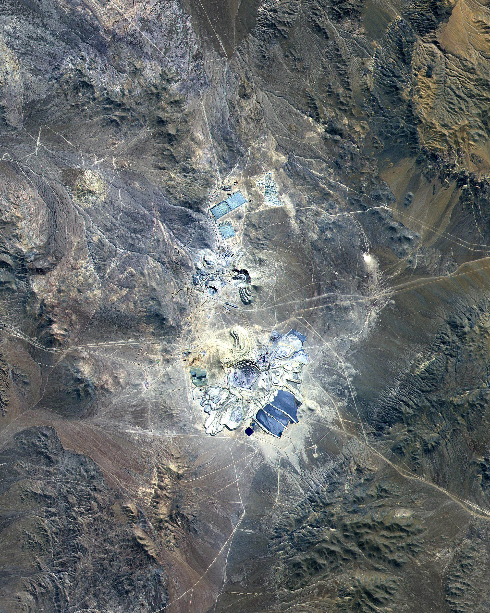
Sample Images