Client
Airbus Neo Challenge and Sustainability
Location
Burrup, Western Australia
Area captured
39sqkm - Covering 3 known mangrove areas.
Satellites
Pléiades Neo, Airbus Defence and Space
Services provided
Tasking, change detection and machine learning
Client
Airbus Neo Challenge and Sustainability.
Challenge
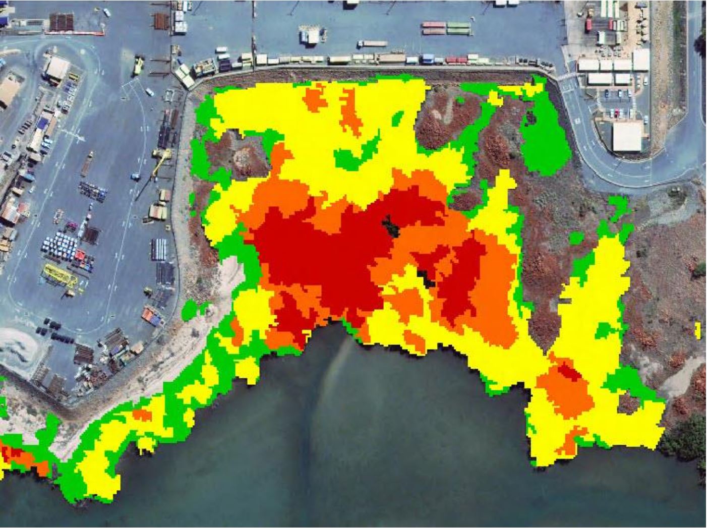
To map the distribution of two dominant mangrove species, Avicennia marina and Rhizophora stylosa, in a sensitive tidal environment, allowing a local industrial development to monitor any impact operations may have on the the mangrove habitats.
Solution
Geoimage explored the potential for using Pleiades Neo 6-Band for accurately classifying the distribution of two mangrove species in an area that has been under study since 2017. The aim of the study was to assess if the 6-Band 30cm data would provide enough information to classify the mangrove distribution compared with WorldView-2 8-Band 50cm data.
The WorldView-2 (WV-2) has been successfully used for classifying the mangroves in the study areas for many years. Pléiades Neo captured imagery of the same region, and machine learning (ML) was employed on both the Neo and WV-2 datasets using identical parameters to classify the mangroves into four distinct categories, Avicennia marina, Rhizophora stylosa, mixed Avicennia and Rhizophora and scatted Avicennia.
Outcomes
The results showed that Pléiades Neo classification was spatially more accurate than the 50cm classification. Specifically, the higher resolution Near-infrared (NIR) band of the Pléiades Neo was able to precisely map areas where the two types of mangrove species intermixed. Overall, the results showed that the mangrove habitats were stable in extent and distribution. By utilising the Pléiades Neo constellation, the study successfully mapped the common mangrove species with high accuracy, particularly for small clusters containing only a few trees. This improved mapping technique enables a more detailed evaluation of subtle changes to the mangrove ecosystem.
Benefits
Geoimage successfully overcame the challenge of mapping the extent of the two primary mangrove species in Burrup, Western Australia by leveraging the Pléiades Neo constellation and machine learning. This approach resulted in considerably improved accuracy and efficiency. The precise mapping of mangrove habitats will enable informed decision-making regarding industrial development and environmental conservation efforts. This mapping technique will allow for more detailed monitoring of changes to the mangrove ecosystem, ensuring the long-term conservation of this vital habitat.
You can read more about how services such as WorldView-2 and Pléiades Neo can benefit you via our website or speak to our team via the Contact Us tab or call us on 1300 143 350.