Area captured
25 sq. km
Satellites
WorldView 3
Services provided
Orthorectification, Pansharpening, Spectral Analysis
Challenge
In mineral exploration, understanding the distribution and composition of minerals is crucial for identifying potential deposits. Traditional methods often involve extensive fieldwork and laboratory analysis. The combination of spectral processing with WorldView-3 data, provides a chance to accelerate this process. In this study, the objective is to efficiently use WorldView-3 data to detect and map minerals in a location with known geological complexity, lithological variety, and mineral reserves.
Solution
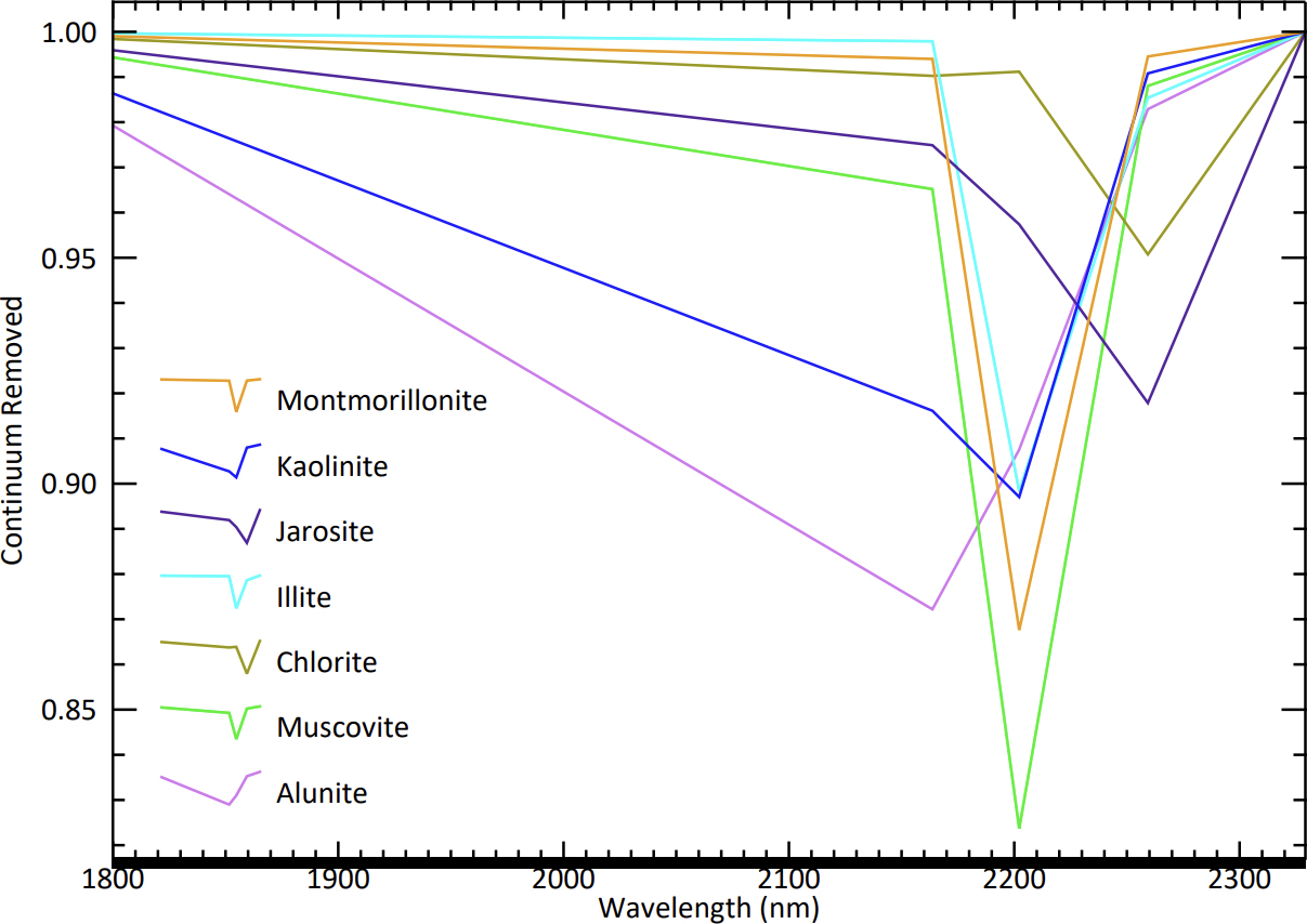
To address this challenge, a comprehensive remote sensing approach was adopted, leveraging pre-existing knowledge and data resources. The process began with the acquisition and processing of WorldView-3 imagery for the area, followed by the application of radiometric and atmospheric corrections to ensure accurate spectral data. Band ratios and RGB composites were generated to highlight mineralogical variations, and different spectral analysis tools were used to identify each mineral. Spectral classification algorithms were then employed to map alteration minerals based on their unique spectral signatures.
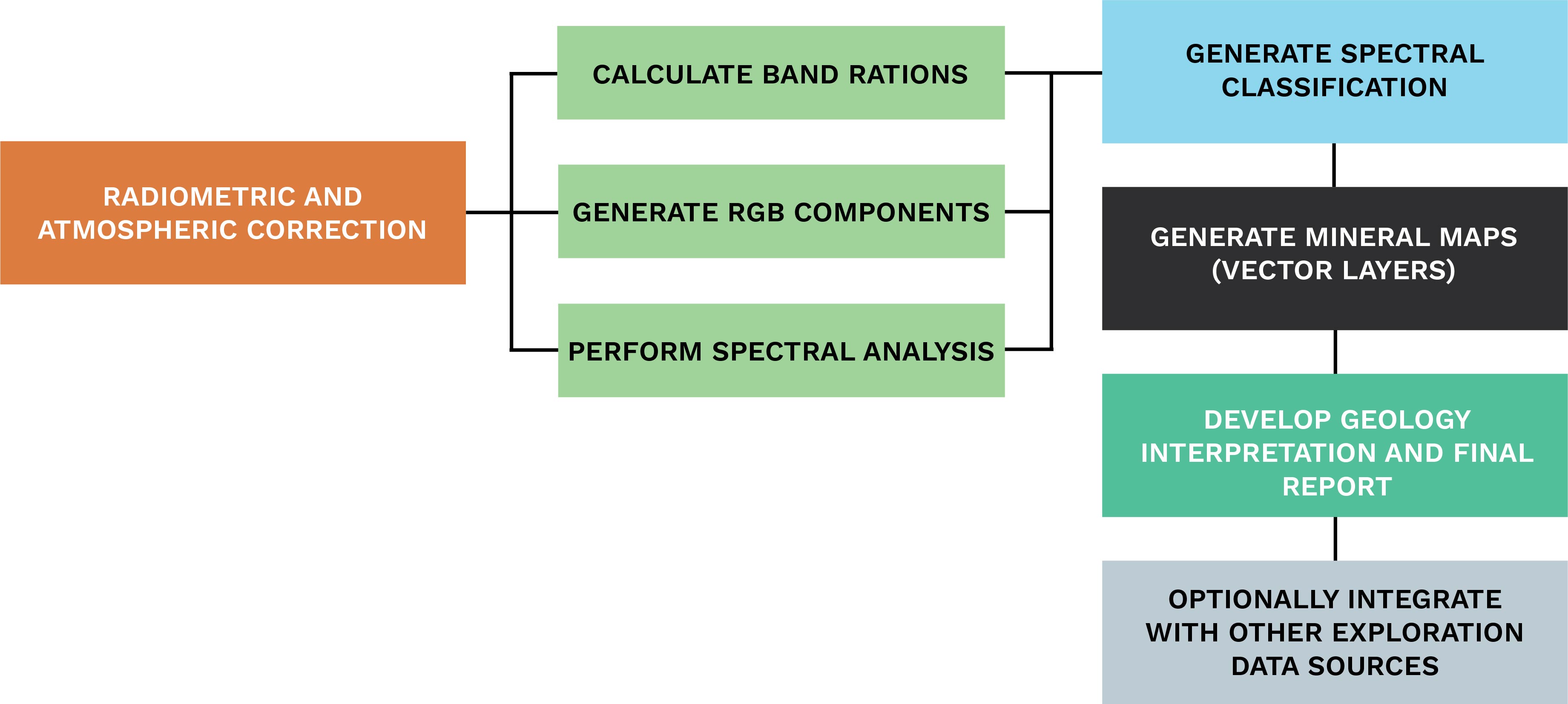
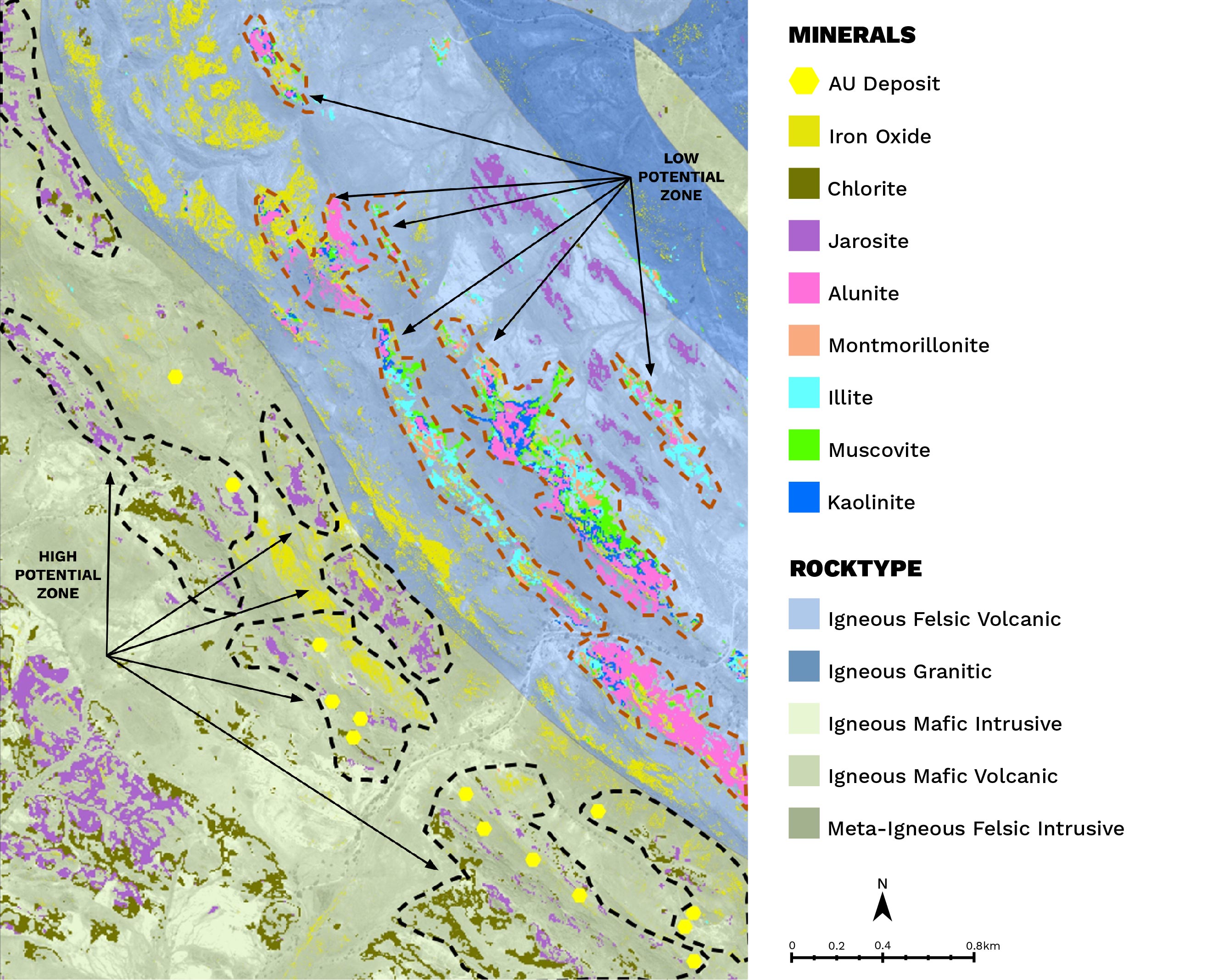
The results were presented as mineral maps with an overlay of vector layers, allowing for precise delineation of mineral distributions. Finally, the mineral maps were interpreted in the context of geological knowledge, existing mineral deposits, geochemical and geophysical data, and detailed geological maps showing lithological units, leading to the creation of a comprehensive final report.
Outcomes
The spectral analysis of WorldView-3 data produced valuable insights into the mineral distribution within the study area. The outcome showed that felsic granitic and volcanic rocks had formations of clay minerals such as kaolinite, illite, and montmorillonite as well as muscovite, iron oxide, and alunite. Additionally, mafic igneous rocks were found to include clusters of iron, jarosite, and chlorite/epidote minerals. The presence of alteration minerals indicates the potential presence of valuable mineral resources. Specifically, high-potential zones are those altered formations within mafic rocks where gold (AU) deposits are known to exist. Even though they are ranked lower, the alteration minerals found in felsic rocks are still considered to be of potential significance.
Benefits
The utilisation of spectral processing with WorldView-3 data has delivered notable advantages for mineral exploration. WorldView-3 data has enabled efficient mineral mapping across extensive areas, reducing the necessity for extensive on-site fieldwork. Furthermore, the use of vector layers has supplied precise and comprehensive information regarding mineral distribution, thereby enhancing targeted exploration efforts. In the assessment of mineral potential, the identification of high-potential zones for mineral deposits, particularly gold deposits within mafic rocks, has been facilitated by the analysis of alteration minerals in both felsic and mafic rock formations. This approach has provided valuable insights for planning exploration activities.
- Reduce necessity for extensive on-site fieldwork
- Cost effective approach compared with traditional exploration methods
- Integrates with other exploration data sources
Conclusion
Spectral processing using WorldView-3 data, when coupled with pre-existing geological knowledge and other remote sensing technologies, offers a powerful tool for mineral exploration. This outcome demonstrates the effectiveness of the approach in identifying alteration minerals associated with mineral deposits, distinguishing high-potential zones, and streamlining the exploration process. By leveraging spectral information, mineral exploration becomes more efficient, cost-effective, and targeted, ultimately contributing to the successful discovery of valuable mineral resources in complex geological terrains.
Download the sample data from this case study
Simply fill out the form below to access the free sample data associated with this case study. You'll be able to examine the results firsthand. If you have any questions or require assistance in identifying alteration minerals, our expert team is here to help.