29 March, 2023
Geoimage showcases Pléiades Neo imagery potential in Global Pléiades Neo Challenge
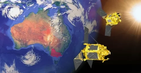
Geoimage recently participated in the Global Pléiades Neo Challenge, an initiative from Airbus to challenge specialists around the world to use Pléiades Neo imagery to demonstrate the potential of this latest addition to the Airbus satellite portfolio. Pléiades Neo captures 6 bands and has a panchromatic resolution of 30cm. The spectral bands include deep blue, blue, green, red, red edge, near-infrared and panchromatic. Participants could select any area in the world and capture fresh imagery or use data from the rapidly growing Neo archive. The event culminated with presentations from entrants on March 16 in Paris, France and online. The challenge offered a unique opportunity for participants to test the capabilities of Pléiades Neo 30cm resolution images in real-world scenarios.
During the event, 17 use cases were presented, spanning diverse domains such as coastal monitoring, cliff erosion, city vegetation mapping, archaeology, and others demonstrating the vast potential of Pléiades Neo imagery. Geoimage was one of only two commercial organisations globally that were selected to participate in the event, with the remainder being academic and research institutions.
Geoimage presented their findings on monitoring the mangrove habitats in Burrup, Western Australia, using the Pléiades Neo constellation and machine learning to map the mangroves more accurately and efficiently. This collaborative project with Airbus proved beneficial for both parties, allowing Geoimage to explore new possibilities with their own expertise and creativity.
Mark Covington, the General Manager of Geoimage, expressed his thoughts on the event, “Participating in the Pléiades Neo Challenge gave us an excellent opportunity to test some hypotheses on the application of Neo to mapping common mangrove species in Australia and it was really insightful to see the applications presented by the other participants. High resolution 30cm, rapid revisit, multispectral is really opening some new doors in terms of applications.”
As the only Diamond Partner of Airbus in Australasia, Geoimage continues to leverage the latest advancements in satellite technology to deliver innovative and effective solutions to their clients.
You can read Geoimage’s case study here and the other case studies here.