07 February, 2023
Geoimage to deliver whole-of-state mosaics and tasking for the Digital Twin Victoria program
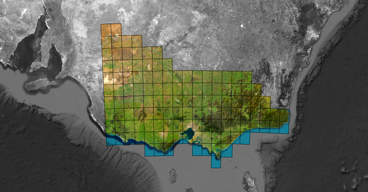
Geoimage, a prominent independent specialist in satellite imagery and geospatial solutions, has been selected by the Victorian State Government’s Digital Twin Victoria program to produce several state-wide epochs over an 18-month period. The first of the three epochs has been successfully captured, processed, and mosaicked by the Geoimage technical team, while the second capture is currently underway.
To create the more than 300,000 km² whole-of-state mosaic and orthorectified images, Geoimage will utilise high-resolution optical data captured by the Airbus Defence and Space SPOT 6/7 constellation. This constellation consists of two satellites, which doubles the capture rate and has a ground resolution of 1.5m and a 60km swathe width capturing capacity. With this combination of two satellites and wide swathe widths, the SPOT 6/7 constellation is ideal for capturing large areas that state and territory governments often require within tight time frames.
According to Mark Covington, the General Manager of Geoimage, the company has established specific workflows and dedicated computing infrastructure to streamline the processing of SPOT 6/7 data, enabling it to deliver high-quality mosaics over very large areas.
“With decades of experience in producing state-wide mosaics for government agencies, Geoimage has perfected its processes through the implementation of in-house solutions, quality checks, and automation,” Mark explained. “With these solutions, Geoimage will be able to deliver high-quality mosaics to the Victorian government within a short timeframe.”
Geoimage is delighted to support the Victorian State Government as part of its Digital Twin Victoria program, a program designed to set the digital foundations for a future-ready Victoria.